Explore how Google/Apple Maps blur sensitive data on Street View.
The diagram below presents a possible solution that might work in an interview setting.
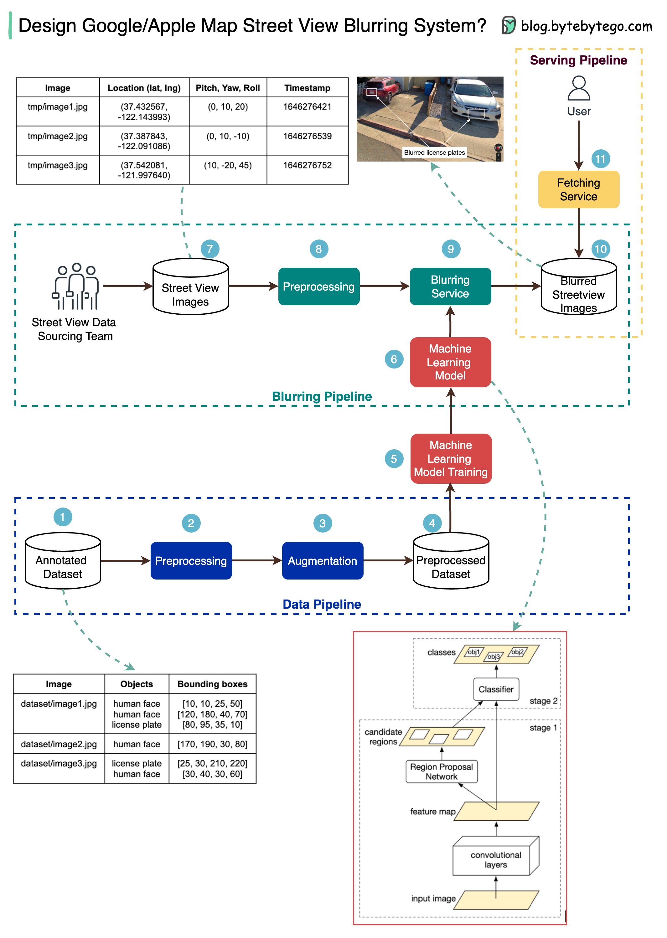
The high-level architecture is broken down into three stages:
Step 1: We get the annotated dataset for training. The objects are marked in bounding boxes.
Steps 2-4: The dataset goes through preprocessing and augmentation to be normalized and scaled.
Steps 5-6: The annotated dataset is then used to train the machine learning model, which is a 2-stage network.
Steps 7-10: The street view images go through preprocessing, and object boundaries are detected in the images. Then sensitive objects are blurred, and the images are stored in an object store.
Step 11: The blurred images can now be retrieved by users.
